Technology
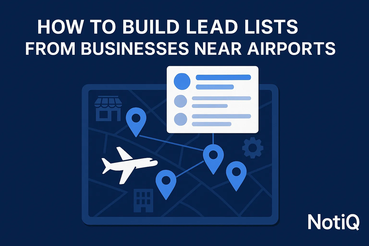
How to Build Lead Lists From Businesses Near Airports
Learn how to build targeted lead lists from businesses near airports using radius planning, enrichment, and segmentation. This guide shows revenue teams how to turn airport proximity into higher-quality outbound.
1. Introduction
Most local lead lists are broad, noisy, and notoriously weak on relevance. When revenue teams rely strictly on generic city filters or standard ZIP codes, they miss the real-world commercial patterns that actually drive business behavior. This results in outreach that feels disconnected, generalized, and easy to ignore.
However, airports create highly concentrated business ecosystems. In these zones, hospitality, logistics, rentals, parking, travel services, and adjacent B2B operators share urgent, recurring operational needs. By targeting these specific geographic hubs, sales teams can uncover accounts with predictable pain points, high turnover rates, and specialized supply chain requirements.
This article will show you how to move beyond basic “businesses near airports” to generate segmented, enriched, and outreach-ready account lists. Designed for advanced revenue teams, this guide focuses on repeatable workflow design rather than basic local B2B lead generation.
The core differentiator in this strategy is that airport proximity is not just a geographic filter; it is a powerful Ideal Customer Profile (ICP) signal when combined with category, firmographics, and operational fit. By bridging raw map-based discovery and sales-ready workflows, NotiQ provides a practical angle for revenue teams to capitalize on location-based prospecting. Readers looking to explore more advanced outbound and workflow strategy content after this guide can find additional resources at Blog.
2. Why Airport Proximity Is a Strong Prospecting Signal
Geographic relevance often improves targeting far more effectively than generic local list building. When you isolate businesses operating near an airport, you are not just capturing an address—you are capturing a specific operational environment.
Airport adjacency can indicate a high degree of time sensitivity, traveler dependence, specialized transport needs, commercial fleet usage, shift operations, and logistics complexity. The true value of this strategy comes from combining physical proximity with business model relevance. It is not about assuming every nearby business is a fit; it is about finding the businesses whose operations are fundamentally shaped by the airport.
This stands in stark contrast to broad “local business leads” approaches that ignore context entirely. According to public research on airports’ off-airport economic impact, airports heavily influence surrounding lodging, dining, retail, engineering, and service activity, driving measurable economic multipliers in nearby commercial zones. Furthermore,FAA airport land use compatibility guidance illustrates how airports dictate surrounding land use patterns, creating structured, predictable commercial zones ideal for geospatial prospecting.
Why airport ecosystems outperform generic local lists
Simple local search involves pulling a list of businesses within a city limit. Ecosystem-based prospecting involves targeting a network of interconnected businesses driven by a central economic engine. Generic local lead lists lack relevance because they group a downtown boutique with an industrial warehouse.
By contrast, airport-based targeting vs generic local search surfaces clusters with highly coherent pain points. A hotel and a shuttle service next to an airport share concerns about flight delays, 24/7 staffing, and fleet maintenance. This shared context allows for highly personalized outreach angles. SDR and RevOps teams benefit immensely when territory design follows this real-world commercial density rather than arbitrary city boundaries, making local B2B lead generation significantly more effective.
What airport proximity actually signals
Proximity to an airport provides actionable geo-intent lead generation data. Common signals include high traveler traffic, continuous freight movement, temporary demand spikes, heavy business travel, massive parking demand, frequent shuttle movement, and complex multi-location service delivery.
However, these signals matter differently depending on the facility. International hubs drive intense hospitality and passenger service needs. Regional airports may support localized business travel. Cargo airports signal heavy logistics, warehousing, and trucking needs, while private aviation corridors cater to high-net-worth services and specialized maintenance.
It is vital to avoid overgeneralization. Not every nearby office or retailer depends on the airport. Successful airport proximity targeting focuses strictly on the businesses near airports whose revenue and operations are tied to the tarmac.
Where this strategy fits in modern outbound
Airport-based prospecting sits strategically between generic lead databases and highly technical GIS (Geographic Information Systems) analysis. There is a distinct gap in the market: most geospatial tools vs sales intelligence tools either help extract raw data or analyze complex maps, but very few explain how to turn these spatial signals into ICP-aligned lists.
This location-based prospecting workflow provides a structured, compliant, and highly targeted alternative to fragmented geospatial prospecting workflow methods or manual, scraper-only approaches. By using legitimate, publicly accessible data enrichment workflows, revenue teams can operationalize spatial signals without relying on unethical or non-compliant data extraction.
3. Which Airport-Adjacent Businesses Are Worth Targeting
To build effective airport district sales leads, you must identify high-value categories and distinguish genuinely airport-dependent businesses from generic nearby accounts. By organizing categories based on operational dependency on airport activity rather than arbitrary map results, you can pinpoint the best businesses near airports for B2B prospecting.
According to TRB research on commercial development around airports, commercial patterns around airports follow distinct development cycles, making certain verticals highly receptive to targeted B2B solutions.
High-fit categories with strong airport dependency
The most valuable businesses near airports rely directly on airport traffic, freight, traveler turnover, or business travel patterns. High-fit categories include:
• Hotels and Motels: High turnover, 24/7 operations, and reliance on traveler volume make hotel leads near airports highly lucrative for software, staffing, and maintenance vendors.
• Airport Parking and Shuttle Providers: These require fleet management, routing software, and automated ticketing systems.
• Car Rental Businesses: High-volume customer processing and vehicle maintenance needs.
• Logistics and Warehousing: An airport logistics companies list is a goldmine for supply chain software, material handling equipment, and commercial real estate services.
• Traveler-Oriented Service Operators: Urgent care, currency exchange, and localized travel corridor leads.
These categories offer clearer outreach messaging than generic “local businesses” because their operational urgency and distributed locations are directly tied to flight schedules and cargo volume.
Adjacent service businesses that can still be valuable
Beyond direct dependency, second-order airport dependence yields excellent airport area business leads. These adjacent service businesses include restaurants, maintenance services, commercial cleaning, staffing agencies, fleet support, IT support, and B2B vendors that service airport-adjacent tenants.
For example, a commercial HVAC company located near an airport may not serve travelers, but its primary revenue might come from servicing the massive climate-controlled warehouses nearby. Assessing this indirect influence allows you to capture geo-intent lead generation opportunities that competitors miss.
How to separate airport-dependent accounts from generic nearby businesses
Category alone is not enough to qualify a lead. To avoid noisy radius-based searches, you must combine category with messaging clues, service offerings, and location context.
Screening criteria for identifying airport-dependent businesses include:
• Airport-themed branding (e.g., "JFK Logistics" or "O'Hare Airport Parking").
• Advertised shuttle services or 24/7 operations.
• Business-travel positioning or specific traveler reviews.
• Direct physical proximity to cargo zones or terminal entrances.
You must actively filter out false positives. A suburban dentist's office or a generic retail strip mall that happens to fall inside a geographic radius will not respond to airport-themed outreach. Knowing how to qualify airport-area business leads ensures your sales team spends time only on relevant accounts.
4. How to Define the Right Radius or Geofence
Defining the correct boundary is crucial. One-size-fits-all radius rules create noisy data and dilute campaign relevance. Selecting boundaries that match the airport type, commercial density, and your specific campaign goals is the foundation of effective commercial radius targeting.
As noted in the FAA airport land use compatibility guidance, the influence an airport exerts on its surroundings is spatially structured, not random. Proper territory planning using geodata for airport leads must respect these structures.
Use a three-zone model for cleaner prospecting
To determine how far from an airport should you prospect businesses, utilize a three-tier model:
1. Core Airport Zone (On-site or adjacent): Terminals, on-site cargo facilities, and immediate rental car hubs.
2. Immediate Service Ring (1-3 miles): Airport hotels, off-site parking, immediate warehousing, and fast-turnaround logistics.
3. Broader Airport Ecosystem (3-10 miles): Logistics parks, secondary hotel corridors, fleet maintenance hubs, and adjacent service providers.
Fit quality changes by distance. “Closer” is not always “better.” If your target buyer is a massive freight forwarder, they likely sit in an industrial corridor slightly farther out, where land is cheaper, rather than directly next to a passenger terminal. Proper airport proximity targeting accounts for these nuances.
When a radius works—and when it creates noise
Simple radius-based lead generation near airports is useful for speed and repeatability. Drawing a 3-mile circle is fast. However, it creates noisy radius-based searches when an airport is bordered by a residential neighborhood on one side and a major highway on the other.
In cases involving irregular commercial districts, highways, or logistics parks, geofencing and polygon-based logic are far superior. Geospatial prospecting allows you to draw boundaries specifically around the commercial and industrial corridors where your buyers actually operate, cutting out the residential noise entirely.
Adjust boundaries by airport type
Commercial sprawl differs dramatically by airport profile.
• International Hubs: Feature massive, sprawling ecosystems with distinct passenger and cargo zones requiring customized polygons.
• Regional Airports: Often feature a tighter, simpler commercial radius targeting approach, with mixed-use businesses near airports.
• Cargo Airports: Require boundaries drawn along major interstate highways and logistics parks, ideal for building an airport logistics companies list.
• Private Aviation: Requires hyper-targeted boundaries around Fixed Base Operators (FBOs) and luxury service corridors.
5. How to Enrich and Qualify Airport-Area Lead Lists
Maps and Point of Interest (POI) results are excellent discovery layers, but they are incomplete for real lead generation. Map results lack firmographic depth. To transition from raw data to outbound-ready accounts, you must enrich the data, balancing location, category, and operational fit.
Responsible enrichment is paramount. Following the NIST definition of data minimization and FTC guidance on protecting business data, teams must collect only the data necessary for legitimate B2B sales workflows, ensuring compliance and building trust.
Start with source data, then normalize it
First-pass data typically comes from map results, directories, or place-category sources. To build workable nearby business prospect lists, you must clean category labels, deduplicate listings, and standardize fields like address, website, phone, and business type.
Crucially, multi-location chains (e.g., a Marriott hotel or a FedEx facility) must be tagged separately from independent operators. This normalization prevents a fragmented geospatial prospecting workflow and ensures your team doesn't pitch an enterprise-level account with a small-business script.
Add the enrichment layers that make lists usable
To elevate local B2B lead generation, add firmographic enrichment. Essential layers include company size, location count, industry classification, and likely buyer relevance.
Geospatial prospecting becomes truly powerful when you add secondary signals: review patterns, hiring activity, tech stack, operational hours, and contact depth. These layers are what ultimately separate "mappable businesses" from "workable accounts," providing the proximity-based sales intelligence needed to craft a compelling pitch.
Build a qualification score for airport-area accounts
SDR leaders can convert a loose list into ranked segments by building a qualification score.
Mini Scorecard Example:
• Distance to Airport: Under 2 miles (+10 pts), 2-5 miles (+5 pts).
• Category Fit: Direct dependency (e.g., Hotel, Logistics) (+15 pts), Adjacent (+5 pts).
• Company Size/Multi-location: Fits ICP (+10 pts).
• Operational Dependency: 24/7 hours or shuttle service advertised (+10 pts).
This scoring mechanism dictates how to qualify airport-area business leads, ensuring top-tier airport area business leads are prioritized for manual outreach, while lower-tier leads enter automated nurture sequences.
Handle data responsibly and keep only what you need
Lead list enrichment must be done ethically. Adhere to data minimization principles: collect only what supports your legitimate sales workflows, secure the data properly, review retention policies regularly, and avoid excess extraction.
Following FTC guidance on protecting business data is not just a legal safeguard; it is a trust-building best practice. When you combine location data with business intelligence, ensuring compliance protects your brand and respects the businesses you are prospecting.
6. How to Prioritize Segments and Personalize Outreach
Turning a qualified list into campaign-ready segments requires grouping accounts by operational similarity rather than treating them as one generic airport list. Distance, dependency, and business model fundamentally alter the messaging. When you know how to prioritize airport-area business leads, you achieve better reply relevance, cleaner territories, and easier campaign testing.
Prioritize by revenue potential and operational fit
SDR and RevOps teams should rank segments using category value, account size, likely urgency, and density around the airport. Territory planning using geodata for airport leads allows you to separate strategic, high-value accounts from high-volume local accounts.
For example, a massive third-party logistics (3PL) operator near a cargo airport should outrank a generic retailer situated next to a terminal hotel cluster. Geospatial prospecting allows you to visualize and prioritize these high-value airport district sales leads efficiently.
Build segment-specific outreach angles
Airport context allows for specific personalization that easily outperforms generic "saw your business online" outreach.
Consider these geo-intent lead generation messaging themes:
• Hotels: Focus on occupancy rates, traveler demand fluctuations, local competition, and 24/7 service responsiveness. (Ideal for hotel leads near airports).
• Parking/Shuttles: Address vehicle turnover, route efficiency, automated booking flows, and traveler operations.
• Logistics/Warehousing: Highlight time sensitivity, fleet coordination, and distributed operations. (Perfect for an airport logistics companies list).
• Rentals/Travel Services: Discuss seasonal demand, location coverage, and traveler convenience.
To scale this personalized outbound effectively once segments and messaging angles are defined, integrating specialized outreach tools can be highly effective.Home offers solutions to scale personalized outbound efficiently.
Create outreach-ready segment lists, not one giant export
Avoid handing SDRs one massive spreadsheet. Split lists by airport type, business category, and scoring tier. Segmented outreach improves A/B testing, ensures clear account ownership, and simplifies campaign reporting. Airport ecosystems inherently support verticalized outbound better than one-size-fits-all local B2B lead generation campaigns. By organizing your airport area business leads into distinct operational buckets, your sales team can maintain a consistent, highly relevant narrative all day.
7. Tools, Workflow Design, and Operational Best Practices
To succeed in location-based prospecting, you must tie this strategy into a repeatable workflow that advanced teams can operationalize. The goal is sales usability, consistency, and repeatability over technical novelty.
A practical airport-area lead generation workflow
If you want to know how to build lead lists from businesses near airports, follow this sequence:
1. Define the Target: Select the specific airport ecosystem based on your ICP.
2. Choose the Boundary: Apply a tiered radius or custom geofence based on commercial density.
3. Collect Businesses: Identify entities within the boundary using compliant place-data sources.
4. Normalize Data: Clean categories and standardize formatting.
5. Enrich: Add firmographics and contact data.
6. Score: Apply the qualification scorecard.
7. Segment & Activate: Group by operational similarity and push to your outreach platform.
This geospatial prospecting workflow must include clear decision points: when to expand the radius if lead volume is low, when to switch categories, and when to enrich further. It must remain simple enough for revenue teams to execute without relying on data scientists.
Where typical approaches fall short
Typical local B2B lead generation approaches fail in specific ways.
• Generic Lead Databases: Tools offering ZoomInfo geographic filtering or Apollo list building filters are excellent for contacts but often lack the contextual spatial relevance needed to map a true commercial ecosystem.
• Manual Google Maps: Searching manually is slow, unscalable, and lacks firmographic depth.
• Full GIS Platforms: Solutions like CARTO spatial analytics are incredibly powerful but often too technical for day-to-day sales teams.
The competitor gap is clear: extraction tools stop at raw data, while GIS tools require specialized training. The winning workflow combines geographic signal with enrichment and outbound execution seamlessly.
Operationalize the process with a central workflow layer
To eliminate a fragmented geospatial prospecting workflow, revenue teams need an orchestration layer that connects discovery, enrichment, scoring, and repeatable execution.
Centralizing this process reduces the friction of bouncing between maps, directories, enrichment tools, and outbound CRM systems. By utilizing AI workflow orchestration, teams can seamlessly turn raw map data into prioritized, outreach-ready campaigns. To see how this centralization bridges geospatial logic and outreach execution, explore[Home](/). This approach ensures that proximity-based sales intelligence translates directly into booked meetings.
8. Future Trends in Geospatial Prospecting for Revenue Teams
Airport-area targeting is just the beginning. It fits perfectly into larger shifts in outbound strategy, where territory planning is becoming increasingly dynamic and data-driven.
From static territory filters to dynamic spatial segmentation
The era of assigning sales territories strictly by state or ZIP code is ending. The trend is moving toward AI-assisted territory design, combining maps, firmographics, and CRM signals.
Airport ecosystems serve as the perfect, practical entry point for more sophisticated geospatial prospecting. Revenue teams increasingly demand signals tied to real-world operations—like proximity to a major supply chain hub—rather than just relying on static company database fields. Territory planning using geodata for airport leads proves that dynamic spatial segmentation yields higher conversion rates.
Why hyperlocal B2B targeting is becoming more important
As buyers become fatigued by mass automated emails, there is a reduced reliance on broad audience targeting. Hyperlocal B2B prospecting is rising in importance because location signals strengthen personalization when they map to real business conditions.
Geo-intent lead generation works because it proves to the prospect that you understand their specific operating environment. Airport clusters are one of the clearest, most profitable examples of how location-based prospecting can cut through the noise and deliver context-rich outbound.
9. Conclusion
Airport proximity works best as a strategic ICP signal, not just a simple radius filter. By looking at the commercial ecosystem surrounding an airport, you can identify businesses with shared, urgent operational needs.
The repeatable workflow is clear: identify the right airport ecosystem, choose the appropriate radius or geofence, target the right business categories, enrich and qualify the accounts, and prioritize segments for tailored outreach.
The ultimate goal of location-based prospecting is not simply to collect more local businesses, but to build highly relevant, high-converting B2B lead lists. Stop relying on ad hoc searching and generic city filters. Operationalize your airport-area prospecting through a repeatable, intelligent workflow.
NotiQ serves as a practical bridge between map-based discovery and revenue-team execution. Discover how to operationalize your airport-based lead generation workflows today at[Home](/).
Frequently Asked Questions
- How can you build lead lists from businesses near airports?
- To build lead lists from businesses near airports, follow a structured workflow: pick a specific airport, define a tiered radius or custom geofence, collect the nearby businesses using compliant data sources, normalize the categories, enrich the list with firmographic data, score the accounts for fit, and segment them for personalized outreach.
- What types of businesses near airports are best for B2B prospecting?
- The best businesses near airports for B2B prospecting include hotels, parking facilities, shuttle services, car rentals, logistics providers, warehousing, and traveler-oriented service providers. Additionally, adjacent B2B service firms like commercial cleaning, fleet maintenance, and IT support that service airport tenants are highly valuable.
- How far from an airport should you prospect businesses?
- How far from an airport should you prospect businesses depends entirely on the airport type, commercial density, and your target category. Instead of a fixed radius, use a tiered zone approach: a core on-site zone, an immediate 1-3 mile service ring, and a broader 3-10 mile ecosystem for logistics and industrial commercial radius targeting.
- How do you qualify airport-area business leads?
- You qualify airport-area business leads by scoring them across several dimensions: distance to the airport, category fit, operational dependency (e.g., 24/7 hours or shuttle services), company size, and overall enrichment depth. This proximity-based sales intelligence ensures you prioritize the most relevant accounts.
- Why not just use a standard lead database?
- While standard databases are excellent for contact enrichment, relying solely on ZoomInfo geographic filtering or Apollo list building filters often misses contextual spatial relevance. Airport-based targeting vs generic local search requires proximity logic that standard databases cannot visualize, making a dedicated geospatial workflow necessary for maximum relevance.
Continue Reading
More articles you might find useful
Google Maps Lead Generation for Signage Companies
Learn how sign companies can use Google Maps to find local prospects, identify visible signage gaps, and build a repeatable outreach system. This guide shows how to turn visual research into qualified leads without relying on paid ads or generic lists.
Read the article →
Google Maps Prospecting for Commercial HVAC Maintenance Providers
A practical blueprint for using Google Maps to find and qualify commercial HVAC maintenance prospects. Learn how to prioritize better-fit accounts, spot multi-location opportunities, and build a repeatable outreach workflow.
Read the article →
How to Find Local Businesses With Recently Changed Categories
Learn how to spot and validate Google Business Profile category changes to find local businesses in transition. Turn these high-intent signals into smarter prospecting and better leads.
Read the article →Popular industry lead playbooks
Maps search examples and niche outreach for the verticals teams prospect most.